Analysis of the Representativeness of land use in France by the French Soil Monitoring Network
Résumé
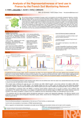
Soil monitoring networks are developed at European scale for soil protection and sustainable management objectives, according diverse sampling strategies. French Soil Monitoring network (RMQS) is based on a systematic 16 * 16 km grid, counting 2200 plots and covering various land use (from arable land to natural land) and various soil types. At the beginning of the programm, a first study enables to establish the minimal density required for a systematic grid-based network and offering an adequate compromise in time and cost for the settlement. The first sampling campaign has been carried out from 2001 to 2009. We need now to guarantee validity and extrapolation of our results at the national level by checking the representativeness of the land use distribution of monitoring sites regards of the whole French land cover. We propose in this study to compare the distribution of the land use for RMQS sites with land use data from two sources of land use data : 1) Corine Land Cover database as exhaustive available land use information for France and 2) national agricultural statistics, providing detailed and annual data concerning crops, grassland and and woodland. The study aims also to detect and interpret local differences between these distribution.
Fichier principal
 RMQS_land_use_representativeness_Eurosoil_2012_1.pdf (1.1 Mo)
Télécharger le fichier
RMQS_land_use_representativeness_Eurosoil_2012_1.pdf (1.1 Mo)
Télécharger le fichier
Origine : Fichiers produits par l'(les) auteur(s)
Loading...